


Garmin U.S., West Inland Maps LakeVü g3 Ultra | LVUS107F | microSD™/SD™
$199.99
Available on backorder
Description
The Premier Freshwater Fishing Map
- Provides exceptional coverage, clarity and detail for inland maps that feature integrated Garmin and Navionics® data
- Auto Guidance¹ technology uses your desired depth and overhead clearance to calculate routes and show a suggested path to follow
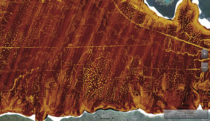
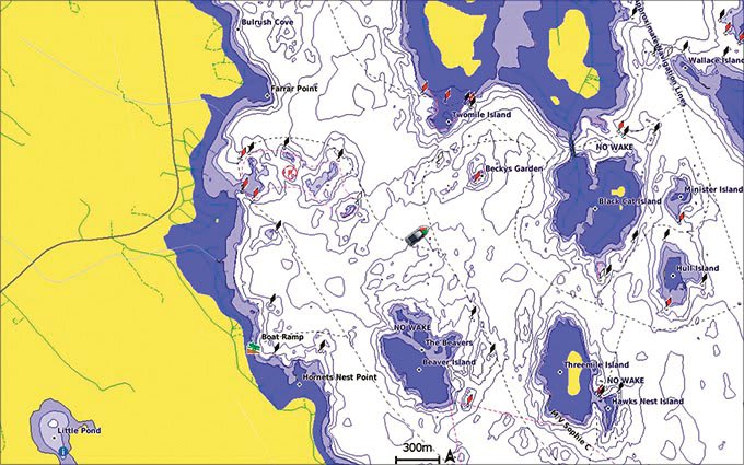
- High-resolution relief shading combines color and shadow to give you an easy-to-interpret, clearer view of bottom structure than contour lines alone
- Sonar imagery shows bottom hardness in vivid color so you can easily identify transition areas on 115 U.S. lakes
- The West card covers more than 7,000 HD lakes with up to 1’ contours, and more than 80 Garmin Elite survey lakes
Experience unparalleled coverage and brilliant detail on the water. LakeVü g3 Ultra inland water maps provide exceptional coverage, clarity and detail with integrated Garmin and Navionics data, Auto Guidance technology1 and high-resolution relief shading.
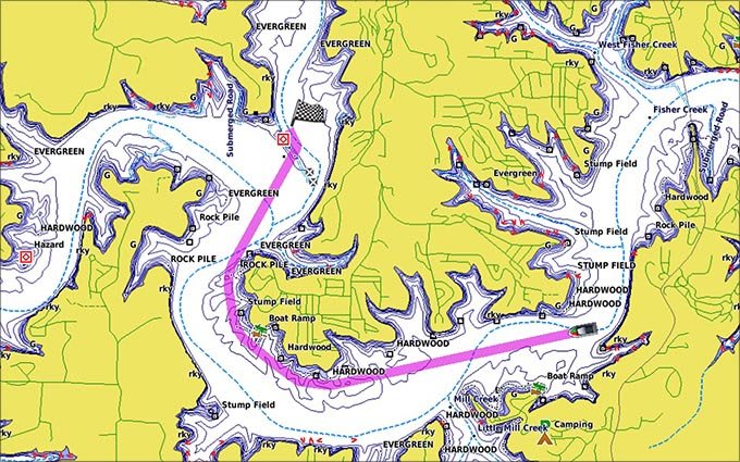
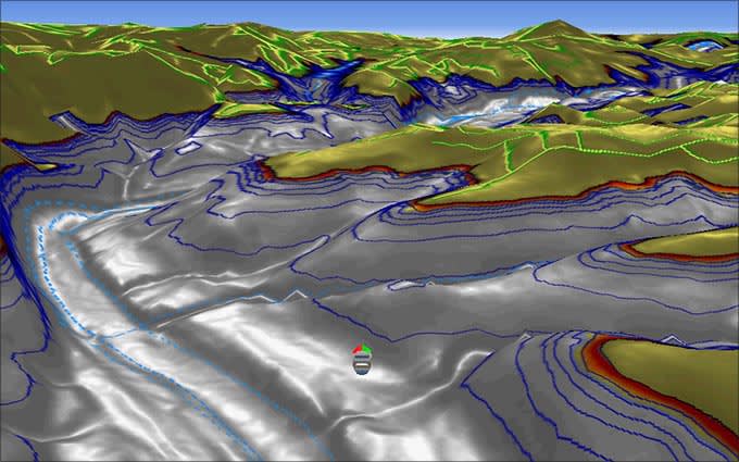
Auto Guidance Technology
The Auto Guidance feature1 uses your desired depth and overhead clearance to calculate a route and suggest a path to follow.
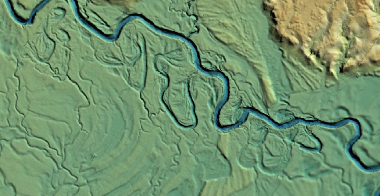
High-resolution Relief Shading Feature
Now with superior coverage, extended high-resolution relief shading combines color and shadows to easily find fish-holding structure, artificial reefs, underwater shelves and more.
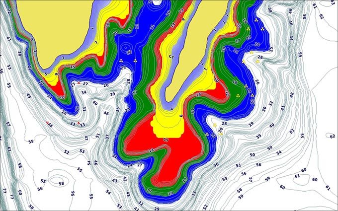
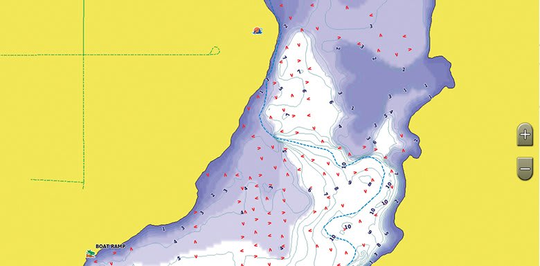
Sonar Imagery
The sonar imagery feature reveals bottom hardness clearly and in vivid color, highlighting both subtle and dramatic transition areas on 115 U.S. lakes.
Depth Range Shading
This feature displays high-resolution depth range shading for up to 10 depth ranges so you can view your designated target depth.
Dynamic Lake Level
This feature allows you to adjust your maps to the lake’s current water levels, giving you a better idea of spots that are either accessible or too shallow to explore.
Shallow Water Shading
To give a clear picture of shallow waters to avoid, this feature allows for shading at a user-defined depth.
Dynamic Lake Level
This feature allows you to adjust your maps to the lake’s current water levels, giving you a better idea of spots that are either accessible or too shallow to explore.
1Auto Guidance is for planning purposes only and does not replace safe navigation operations
Additional information
| Weight | .25 lbs |
|---|
Only logged in customers who have purchased this product may leave a review.


Reviews
There are no reviews yet.